


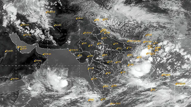
Based on the latest information from international and national forecasting models, the cyclone called Biparjoy is expected to become an even stronger storm in the next following hours. It is currently a very severe cyclone that is expected to bring an even more severe storm once it hits the coast of Karachi. Currently, Biparjoy is located 639 km south of Karachi and has moved northward at 9 km/h (5 knots) over the past 6 hours with a wind speed of 165km/h and a max of 195km/h.
Possible Impact Routes
The Pakistan Meteorological Department (PMD) has reported that the cyclone could follow one of three paths and potentially impact coastal areas of Pakistan. These potential impacts include heavy rain, thunderstorms, and strong winds in the southern and southeastern parts of Sindh province, including Karachi and other cities.
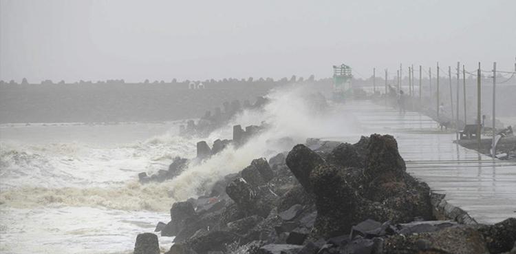
There is a risk of damage to weak structures due to the strong winds, as well as the possibility of storm surges and urban flooding along the coast. The sea conditions will be rough, with high-intensity squalls, making it unsafe for fishermen to venture out into the open sea. Here is a link where you can track the cyclone yourself.
Alert Warning
The National Disaster Management Authority (NDMA), in coordination with PMD, provincial disaster management authorities, Pakistan Navy, Pakistan Maritime Security Authority (PMSA), and Pakistan Coast Guards (PCG), is issuing advisories and guidelines to all authorities at national and provincial levels. They are urging proactive efficient pre-damage control measures to minimize the potential impacts of the cyclone if it does hit the Karachi coast.
سائیکلون الرٹ – ممکنہ اثرات و احتیاطی تدابیر pic.twitter.com/dF0trBLJM1
— NDMA PAKISTAN (@ndmapk) June 9, 2023
- Stay away from electrical poles and wires, buildings, and trees.
- Stay updated with the cyclone news through all media channels.
- Be sure to have all necessary items like food, water, clothes, and medicines before time.
- Fishermen are to stay away from the sea after the 12th of June till the cyclone has passed.
- People also stay away from the sea and the coastal areas and restaurants.
- Follow all given instructions by the authorities.
The NDMA’s National Emergency Operations Center (NEOC) is continuously monitoring the situation and sharing information through its website regarding the projected tracks and impacts of BIPARJOY on the coastal areas. They advise the public to stay informed and follow the official updates and warnings issued by the relevant authorities to protect themselves and their properties from the potential impacts of Cyclone Biporjoy.
Stay tuned to Brandysanrio for more news and updates.