
















El Niño continues to strengthen across the Pacific Ocean, raising concerns about extreme weather in the coming months. Forecasters expect the climate pattern to reach its peak in late 2026 or early 2027. However, its effects could last much longer, bringing unusual rainfall, drought, heat, and storms to different parts of the world.
Key Takeaways
- El Niño has reached the very strong category.
- It could become one of the strongest events recorded since 1950.
- Its peak is expected in late 2026 or early 2027.
- It could increase the risk of floods, droughts, extreme heat, and unusual winter weather.
- Its influence may continue into 2027, with La Niña potentially following.
El Niño Continues to Strengthen
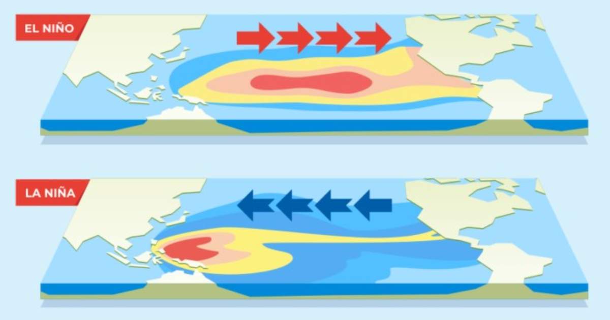
El Niño is a natural climate pattern that develops when surface waters in the central and eastern tropical Pacific Ocean become warmer than usual. These warmer waters affect atmospheric circulation and shift rainfall and temperature patterns around the world.
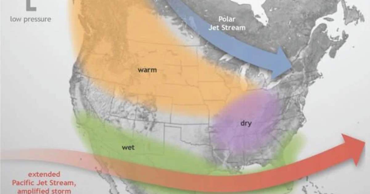
According to NOAA’s Climate Prediction Center, El Niño has continued to strengthen. Forecasts suggest strong-to-very-strong conditions could persist through early 2027. There is also around a 60% chance that the event could exceed previous major El Niños recorded since 1950. Only three previous events reached the very strong category: 1982–83, 1997–98, and 2015–16. Therefore, the current event could become a historic climate event.
When Is El Niño Expected to Peak?
Forecasters expect El Niño to peak between late 2026 and early 2027. However, warmer ocean temperatures do not mean its effects will immediately disappear after reaching their peak.
The atmosphere and oceans can continue responding to El Niño for months. As a result, rainfall, temperature, and storm patterns may remain affected even when the ocean begins cooling.
What Weather Changes Could Follow?
El Niño can influence weather differently depending on the region. Some areas may experience heavy rainfall, while others could face dry conditions. Potential weather changes include:
- Heavy rainfall and flooding: Parts of the southern United States could experience wetter conditions, increasing the risk of flooding and powerful storms.
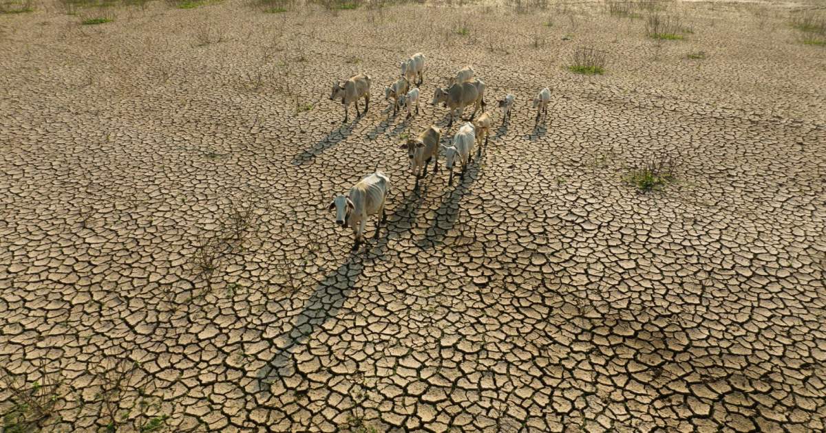
- Drought: Indonesia and other parts of Southeast Asia could experience reduced rainfall, raising concerns about water shortages and agricultural conditions.
- Extreme heat: Some regions may experience higher temperatures, adding pressure on communities, crops, and water supplies.
- Winter weather changes: El Niño could influence storm tracks across the United States, bringing wetter conditions to some areas and potentially affecting snowfall patterns.
These are possible seasonal impacts, not guaranteed outcomes for every location.
Could El Niño Affect Global Temperatures in 2027?
El Niño could contribute to unusually high global temperatures in 2027. It releases heat from the ocean into the atmosphere and influences global climate patterns.
Meanwhile, long-term global warming continues to raise average temperatures. Together, these factors could increase the likelihood of extreme heat in some parts of the world.
Could La Niña Follow Next?
Scientists are also watching for a possible transition to La Niña later in 2027. La Niña brings cooler-than-average sea surface temperatures across the central and eastern tropical Pacific.
If it develops, it could shift rainfall and temperature patterns again and influence the following hurricane season. However, it is too early to predict exactly how strong it will be or what impacts it may bring. For now, El Niño remains a major climate pattern to watch as it continues strengthening. Its influence could shape weather conditions across several regions well into 2027.
FAQS
1. What is El Niño?
El Niño is a climate pattern that warms ocean surface temperatures in the central and eastern Pacific, affecting weather around the world.
2. When is El Niño expected to peak?
It is expected to peak in late 2026 or early 2027.
3. What weather can El Niño cause?
It can increase the chances of heavy rainfall, flooding, droughts, heatwaves, and unusual winter weather in different regions.
4. What is La Niña?
La Niña is a climate pattern in which sea surface temperatures in the central and eastern Pacific Ocean become cooler than average.
5. How does La Niña affect global weather?
It can shift rainfall patterns, influence temperatures, and increase the risk of droughts, floods, and storms in different parts of the world.
Stay tuned to Brandsynario for the latest news and updates.

 Join a Channel
 Brandsynario
 Veryfilmi